
086
FXUS66 KSGX 022034
AFDSGX

Area Forecast Discussion
National Weather Service San Diego CA
134 PM PDT Wed Sep 2 2026

.SYNOPSIS...
It will remain cooler and drier for inland areas through Friday, with
patchy night and morning coastal low clouds spreading into portions
of the western valleys at times. For the holiday weekend into
early next week, Tropical Storm Marie will likely become a
hurricane and is expected to remain well to the southwest of the
area. However, an increase in surf at the beaches is expected.
There could also be an increase in humidity, with more clouds and
a chance of showers and slight chance of thunderstorms.

&&

.DISCUSSION...FOR EXTREME SOUTHWESTERN CALIFORNIA INCLUDING ORANGE...
SAN DIEGO...WESTERN RIVERSIDE AND SOUTHWESTERN SAN BERNARDINO
COUNTIES...

This afternoon...The marine layer remains about 1500 ft deep and a
few low clouds are lingering at the beaches. Otherwise skies are
clear. Temperatures are generally near or a few degrees lower than
at this time yesterday. Sfc pressure gradients remain onshore and
are supporting westerly winds gusting 25 to 40 mph in the mtn
passes and canyons, and on the desert slopes.

From previous discussion...
A low pressure system along the West Coast will maintain stronger
onshore flow at the surface and drier southwest flow aloft
through Friday, with continuing near all-time record sea surface
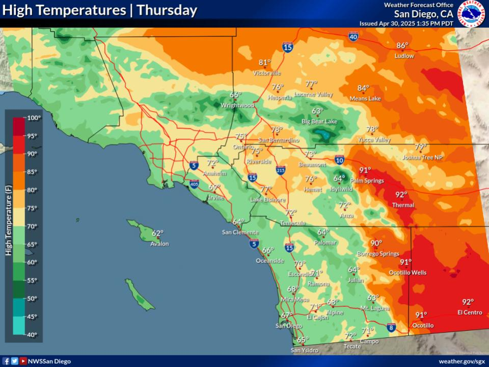
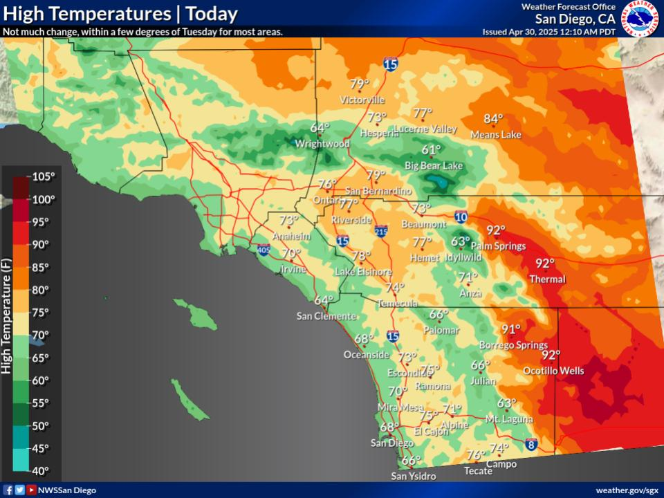
temperatures over the coastal waters. High temperatures for the
mountains and inland valleys will remain as much as 5 to 10
degrees below average while high temperatures near the coast
remain around average. High temperatures will range from the mid
70s near the coast to the mid to upper 80s to lower 90s for the
Inland Empire the lower deserts around 100. Low temperatures will
be a few to around 5 degrees below average for inland areas. Low
temperatures for coastal areas will be mostly in the 60s, in the
mid 50s to lower 60s for the valleys, in the 40s to mid 50s for
the mountains, and in the upper 60s to upper 70s for the lower
deserts. Patchy night and morning low clouds will extend into
portions of the western valleys at times.

Tropical Storm Marie continues to strengthen and is expected to
become a hurricane in the next 12-24 hours while continuing on a
track toward the northwest. In the ensemble guidance, there
continues to be a gradual slow shift toward the south and west
with the highest track density. There continues to be somewhat
greater spread in the track guidance once Marie reaches the
longitude of Point Conception.

The most likely scenario remains that the core of Marie will
remain well to the southwest of the area. Swell from Hurricane
Marie is expected to bring an increase in surf to southern
California beaches during the weekend with the biggest surf for
beaches in Orange and San Diego Counties from Oceanside northward.

Even with the relatively drier solutions, those with the core of
Marie remaining well to the southwest, increase precipitable water
values to more than one inch over the weekend. At the drier end
of the guidance, the NBM 10th percentile precipitable water value
at San Diego increases from around 1 inch for early Saturday
morning to 1.7 inches for early Sunday morning with the
corresponding 50th percentile values at the same times 1.5 and 2
inches.

The low pressure system near the West Coast could draw some of the
mid and high level moisture from Marie into southern California
and the Great Basin bringing a chance of showers and a slight
chance of thunderstorms. Over time from Saturday into Sunday,
where that might occur would be moving slowly northward with time
with the rainfall potential increasing with time as well with the
increasing moisture content of the atmosphere. However, there
remains larger spread in the details.

Nights should be warmer for the holiday weekend. High temperatures
for some inland areas could be a little cooler depending on the
amount of moisture influx and cloud coverage.

&&

.AVIATION...
021800Z...Coast/Valleys...SKC and VFR through this afternoon and
evening. Patchy low clouds based 1400-1900 ft MSL redevelop over
coastal areas and nearshore waters after 06z Thu. Best chance for
intermittent cigs at coastal TAF sites will be around 12-15z. Any
low clouds that develop will clear out again by 16-17z.

.Mountains/Deserts...Mostly clear skies through Thursday morning.
Breezy westerly winds mainly through mountain passes and along
desert slopes 21-07Z. Gusts 25-40 kts with pockets of moderate
up/downdrafts over and in lee of ridges.

&&

.MARINE...
No hazardous marine conditions are expected through Sunday. However,
wind gusts around 20 knots are expected each afternoon and evening
through Thursday in the vicinity of San Clemente Island.

&&

.BEACHES...
Southerly swells from tropical cyclones will continue this week. A
large south swell from Tropical Storm Marie will move into the
region Saturday, likely peaking Sunday-Monday. While there is
uncertainty in the exact track of Marie which could result in
differences in swell and surf direction and height, this will very
likely result in elevated to high surf and strong rip and longshore
currents. Maximum surf of 6-10 feet is forecast for south/southwest
beaches. This will combine with high astronomical tides to increase
the potential for tidal overflow and coastal flooding Saturday
through Monday, highest chances Monday. Stay tuned as details become
clearer in coming days.

&&

.SKYWARN...
Skywarn activation is not requested. However weather spotters are
encouraged to report significant weather conditions.

&&

.SGX WATCHES/WARNINGS/ADVISORIES...
CA...None.
PZ...None.

&&

$$

PUBLIC...PG
AVIATION/MARINE/BEACHES...KW
NWS San Diego (SGX) Office


 6800ft.




 © bensweather